Free downloads
Download the new world map
The new, equal-area world map — every country at its true size, not stretched near the poles the way the old map draws it. Free to download, print and share, for classrooms, offices and walls.


Classroom kit
Everything a teacher needs for one lesson on why the old map looks the way it does. Free to print and share.
The 1569 map and the new map side by side, with the countries each one exaggerates.
A3 PDF · A4 PDF · PNG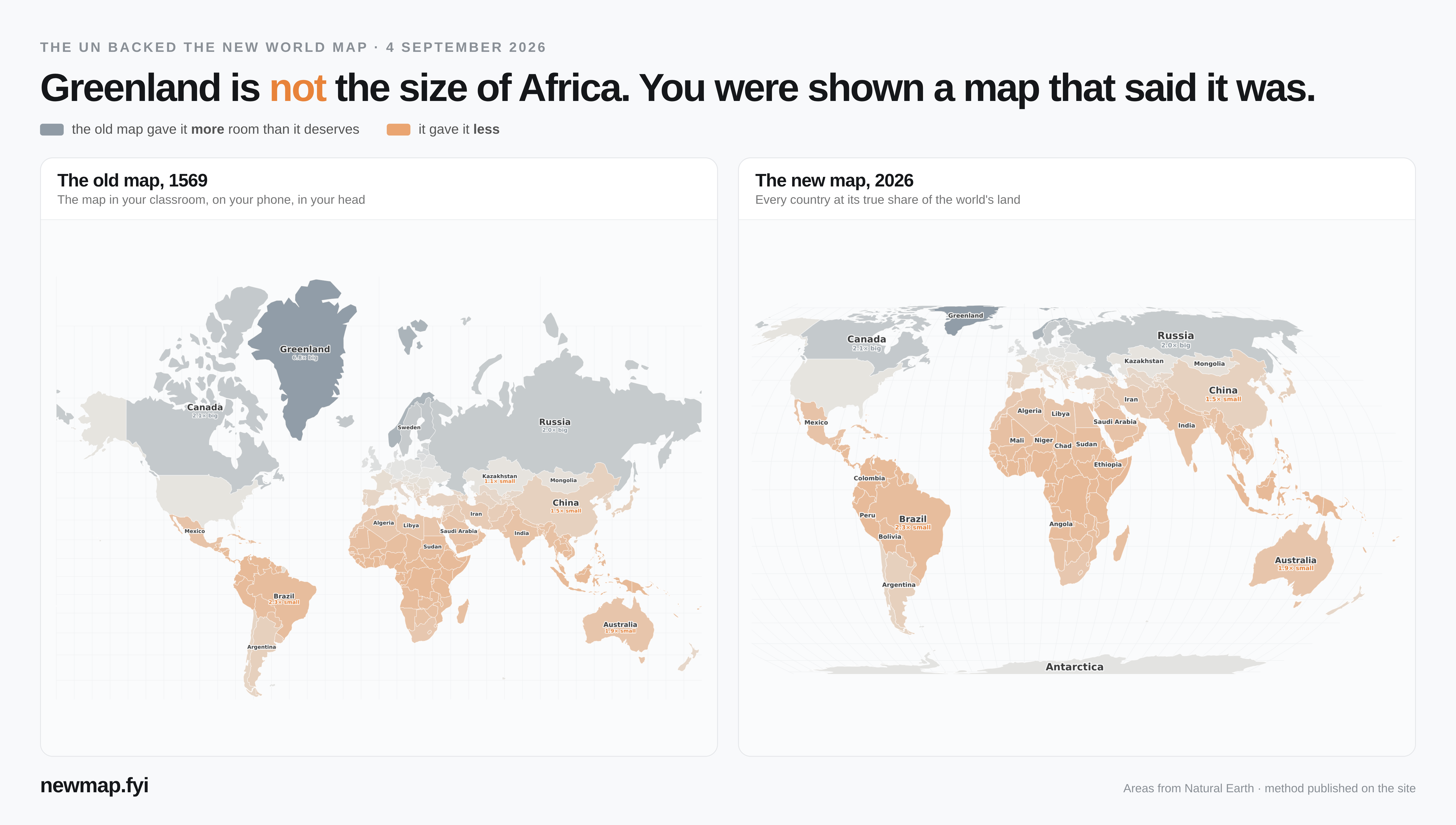
Six questions students answer using the poster and the live map, with an answer key you can cut off.
Worksheet PDF (A4)Project it in class: click any country to see its true size, or play the daily “which is bigger?” game.
Open the map · Daily gameWhy this looks different
The world map most of us grew up with (drawn in 1569) was built for sea navigation, not for comparing country sizes — it stretches everything near the poles. Greenland ends up looking as big as Africa, when Africa is actually about 14× larger. The new map keeps every country at its true size. See the old map vs the new map →
Support the map
This site is free and has no sign-up. If it helped your class or your curiosity, you can keep it running.
Put the map on your site
Teachers, bloggers, newsrooms: paste this into your page and your readers get the live map, playing the old map turning into the new one. Free, no sign-up, no ads inside it.
See any country's true size on the interactive map → · Play today's puzzle → · About